
Kalamazoo Previous Residents by Era
Past residents leave different records in different periods. Kalamazoo County Parcel Search gives the current parcel, owner, situs, mailing address, and parcel ID. The Register of Deeds then supplies the recorded ownership trail. Kalamazoo Public Library, or KPL, supplies the address-and-name layer that ownership records cannot provide. Its directories, reverse books, phone books, maps, and newspaper microfilm help test who lived here before a transfer or after one. A census is a household snapshot on its own census date, not an annual record of occupancy.
| Record trail | Known coverage | Kalamazoo keeper | Best use |
|---|---|---|---|
| Recorded land images | 1831 to present | Register of Deeds portal and counter | Transfers, parties, liens, plats, and legal descriptions |
| Complete deed index | 1984 to present | Kalamazoo County Deeds Search | Party, date, document, book/page, and parcel pivots |
| City directories | From 1860, shelf confirms each run | KPL Local History Room | Name-to-address and address-sequence evidence |
| Criss-cross directories | From 1954, including Bresser volumes in the 1970s | KPL Local History Room | Reverse address-to-occupant research |
| Federal census | Released under the 72-year rule | NARA, KPL, and authorized access | Household composition at one census date |
| Gazette and probate | Gazette nearly complete from 1834; probate records begin 1832 | KPL and Probate Court | Moves, deaths, estates, heirs, and dated context |
For a recent question, begin with the parcel and deed. For a mid-century address, add the criss-cross books. For an earlier Kalamazoo address, find the street form used in that year before relying on a directory. Rural addresses can need the 1919 county directory, the 1926 rural-route volume, or the 1969-70 farm directory instead of the city run.
Kalamazoo Deed Records Need Care
The Kalamazoo County Deeds Search has a free basic index and reports a complete index back to 1984. The county also reports digitized land-record images from 1831. Those statements are not the same promise. An older image may exist while a complete online index does not. If a chain reaches the earlier boundary, use the Register of Deeds counter, its public workstations, or ask about older deed books, microfilm, and legal-description searching.
Search by party name, not only by a street address. The recorder notes that an address is not required on every document. Narrow a broad result with a date range, document number, book and page, or parcel number. The web index limits results to 500, so preserving the date and municipality from each confirmed transfer makes the next search more precise. Index searching is free; images, printing, and saving have the county's stated per-page and technology charges.
| Deeds Search field | How it supports an earlier-address search |
|---|---|
| Name | Search a grantor or grantee, then narrow a common name with a date range. |
| Date Range | Limit results by recording or effective date around a known transfer. |
| Liber/Page | Return to the book-and-page location once an older index reference is known. |
| Document Number | Open the particular county recording when its number is available. |
| Parcel Number | Connect a current parcel when the recorded document carries that identifier. |
The index result should be saved as a small record inventory, not merely a name hit:
- Indexed grantor or grantee name, including the displayed spelling and order.
- Document type, such as deed, mortgage, lien, release, or plat.
- Recording or effective date shown with the result.
- Liber/page or document number, plus the parcel number when linked.
- Whether the needed image requires the county's paid view, print, or save option.
The recorder's grantor-grantee search surface is the starting point for that name-based work.

Use the displayed search options to document each party and date before moving backward to the earlier recorded transfer.
Note: The complete-index date does not mean every older image is unavailable; it signals when counter and legal-description work become more important.
Trace Kalamazoo Past Resident Records
A chain of title is the succession of recorded transfers for a parcel. It is strongest when each link shares the parcel's legal description or an identifiable lot and block, not merely a similar street number. First use Kalamazoo County Parcel Search to record the current assessed owner, parcel ID, situs, mailing address, and legal description. A mailing address may point somewhere else, so it cannot prove residence.
- Find the current parcel by street, owner, or parcel ID, and copy the legal description exactly.
- Search the current owner in the deed index and identify the purchase record by parties, date, document type, and legal description.
- Record the seller, then search that seller as a grantee in an earlier range to locate the prior purchase.
- Repeat the seller-to-earlier-grantee pivot, testing initials, married names, estate or trust names, and spelling variants.
- When a parcel splits or combines, follow the recorded plat, parent parcel, lot, or block rather than forcing today's parcel number backward.
- Grantor
- The party conveying an interest in a recorded document, often the seller in a transfer.
- Grantee
- The party receiving that interest, often the buyer named in the transfer.
- Chain of title
- A documented sequence of transfers that connects one recorded owner to an earlier one.
- Legal description
- The recorded lot, block, plat, or metes-and-bounds description that can remain useful when a street address changes.
Keep a source date beside every result. A public deed index is not a title opinion, and Register of Deeds staff do not conduct title searches or give legal advice. A sale-history tab or tax record can help compare dates, but it does not replace the recorded instrument.
Kalamazoo Address Records Changed in 1925
Kalamazoo's local numbering history is a major previous-residents trap. The city adopted the Philadelphia numbering system in 1883, then changed citywide numbering again in 1925. There is no 1925 city directory. KPL's house-history method is to begin after 1926, work backward, check the target number and the immediately lower and higher numbers, and bridge through a 1922 or earlier directory. A direct comparison of 1924 and 1926 numbers can send a search to the wrong property.
Street names also change. Michigan Avenue was Main, Cork was St James, Oakland Drive was Asylum, Riverview was Seminary, and Vine was Rice. Record the historic name beside the current one. The city directory section begins in street order in 1897, while earlier volumes can require a name search or a manual scan of the street. A year before a person's apparent disappearance can distinguish a move from a missing entry.
Note: For a house that spans the 1924-26 bridge, nearby numbers are evidence to compare, not proof that two entries identify the same household.
Kalamazoo House History Records
KPL's historic-house research guide ties together directories, plats, Sanborn maps, and local database citations. It is especially useful once a deed chain produces a person or an older street form. The library's Central Library Local History Room holds directories, phone books, maps and atlases, yearbooks, local newspapers on microfilm, and related genealogy material. Ask staff for the exact call number, microfilm reel, or citation instead of assuming every item is online.
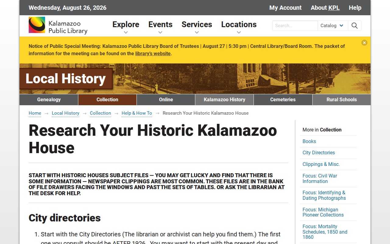
The guide reinforces the local sequence: establish an address form, compare directory years, and use a map or plat to test whether the building and parcel match.
Sanborn maps are building evidence, not occupant rolls. KPL holds bound 1908, 1932, and 1957 volumes and microfilm from the early 1880s. The 1932 Library of Congress map volume has 65 sheets for Kalamazoo and parts of Portage Township. Compare a footprint, porch, outbuilding, materials, and street geometry across map years, then return to deeds and directories for people.
Kalamazoo Previous Residents in Directories
Previous residents are not always prior owners. KPL's criss-cross volumes make a reverse address search possible from 1954 forward, while city directories reach back to 1860. Later books may add telephone numbers, and a small mid-1930s “o” can mark ownership. Earlier entries can show a name, residence address, spouse in parentheses, occupation, “res.” for residence or head-of-household context, and “bds” for boards at. These are period clues, not a claim about a current household.
The volumes themselves, their years, and their reading conventions belong in the Kalamazoo city directories collection. For an address trail, use only the needed year and preserve the printed spelling. A person listed at an address may have been a boarder, student, relative, or renter. That is why a deed and directory often answer different questions.
Note: A reverse listing establishes an address association in that volume, not a continuous residence before or after publication.
Kalamazoo Census Pairing for Past Residents
Pair directory years with released federal census years rather than treating them as interchangeable. KPL describes Michigan census microfilm coverage from 1820 through 1930 and Soundex access for 1880 through 1920. Federal census images follow the 72-year release rule. Use the directory to locate the annual address or name, then use the census to test the household composition on the census date. Different timing and household rules can produce different results without either record being wrong.
- Choose a directory year near a released census year and record the residence form exactly.
- Search the census by name, municipality, and nearby household context rather than forcing the modern number.
- Compare names, ages, relationships, and street context, then mark the evidence as a single-date household snapshot.
- Use the next directory year to see whether the person remained, moved, or simply vanished from the printed index.
County and rural directories can matter outside the city. The 1919 rural directory, 1926 Kalamazoo/Van Buren Rural Route, and 1969-70 farm directory offer alternatives when a property was not within the regular city coverage.
Kalamazoo Records Close the Trail
When a name drops from a Kalamazoo address, the next source may be a Gazette citation, an obituary, probate, a cemetery source, or a permit record. KPL's Local Information Database provides names, files, books, and Gazette citation details; the microfilm is the next stop for the cited article. The Gazette run is almost complete from 1834 to the present, with clipping files strongest from 1928 through 1968. Save the date, title, and page with each finding.
Probate records begin in 1832, with an online index and local files or microfilm at the court. An estate can identify a fiduciary, executor, heir, or later conveyance. Permits and city tax tabs can date a building change, but neither is an occupant list. If sources disagree, preserve the conflict and say what each source actually establishes.
Lawful use. Kalamazoo previous-residents research is for house history, family history, estate questions, and personal curiosity. Do not use a record trail to stalk, harass, intimidate, or harm anyone.